
價格:免費
更新日期:2019-05-28
檔案大小:26.5 MB
目前版本:1.9.1
版本需求:需要 iOS 11.0 或以上版本。與 iPhone、iPad 及 iPod touch 相容。
支援語言:德語, 英語

GPS Track - Hike & Bike is an iOS application for recording the GPS coordinates of your tracks.
◆ Tracking
GPS Track records the GPS coordinates of your tracks, as well as altitude (barometric) and speed.
◆ GPX Export
GPS Track exports your tracks as GPX files which you can use in several applications to view your tracks, tag your photos and more.
◆ GPX Import
You already have a collection of GPX files and you want them all in one place? GPS Track can import them.
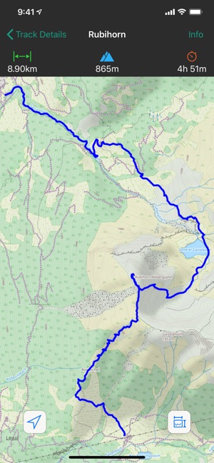
◆ Map View
Your current track is drawn on the map.
You can place needles by long pressing on the map to mark points you are interested in. Tapping on such a needle displays the current distance to it.
Choose between various map types:
Apple Maps (standard, satellite, hybrid)
OpenStreetMap
OpenCycleMap
Landscape
Outdoors
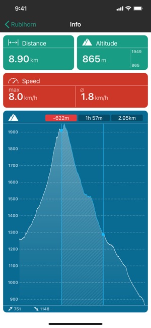
◆ Info
The info screen shows the current track data:
Distance from start
Current altitude, min and max altitude
Speed: Max and average
The altitude profile chart
One or two finger touch on the altidute diagram gives detailled informations
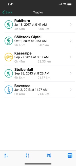
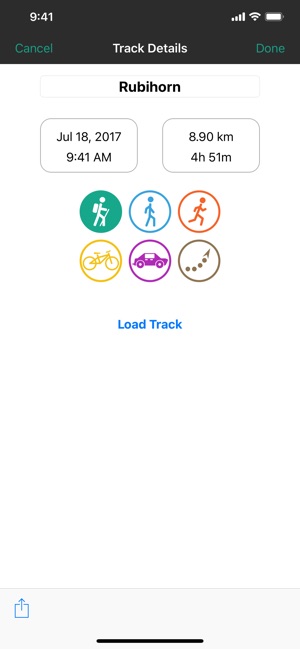
◆ Track Properties
Name your tracks and give them an activity icon.
Your tracks are listed in a nice way. The list can be sorted alphabetically or by date.
◆ Apple Watch Support
Start/stop tracking, show your current location and track infos.
◆ Today Widget
Quickly view your track info at a glance.
◆ 3D Touch
Start and stop your recording with 3D Touch on the App Icon.
Note: Continued use of GPS running in the background can dramatically decrease battery life.
支援平台:iPhone, iPad, Apple Watch